Sunday, May 24, 2015
Crazy Travels on 2 Wheels: The Final Leg Home....
Crazy Travels on 2 Wheels: The Final Leg Home....: Okay....the final part of our journey last summer!! I know it has been a while since I blogged...but the year anniversary of this ...
The Final Leg Home....
Okay....the final part of our journey last summer!! I know it has been a while since I blogged...but the year anniversary of this amazing trip is coming up, so I thought I would finish it up!! When I last wrote, we had made it to Albuquerque and spent the night there. After getting recharged with a good night's sleep and a filling breakfast (which included plenty of black coffee) we took off bright and early for what we knew would be at least a nine hour day of traveling.
Albuquerque is nestled in part of the Rio Grande Valley with the Sandia Mountains to the east, the Sandia Pueblo to the north, and the Isleto Pueblo and the Kirkland Air Force Base to the south. It has one of the highest elevations of any major city in the U.S., varying from 4,900-6,700 feet. The picture above shows a house that I am sure has a spectacular view....if only I could have been invited up there to take a photo!!
This was my attempt to get a shot of a beautiful hot air balloon that was floating high above us....and apparently I missed it!! The city is famous for their annual Balloon Fiesta each October. For over 40 years they have enjoyed hot air balloons, food, music and other activities the first week of October. Check it out here....have to add this to my bucket list for sure.
As we all know....there are many times when things don't go as we have them planned and mapped out! We found this out in a big way on what was supposed to be our last day of travels....our ETA back to Stillwater, Oklahoma should have been around 5 p.m. That plan began to sputter about 50 miles east of Albuquerque....
The Harley had a complete loss of power as we were zipping along Interstate 40. Terry guided it onto the shoulder of the road where he began to investigate possible problems. Of course I began to Google for answers on my phone (yes...I am quite handy at that). Google said to unplug everything and then plug them back in....and whew...it worked!!! After replacing the tools and bags and whatever else we had to remove to get to the plugs, we headed on down the interstate once again....for about 20 miles before it happened again. Oh great!!!
Stopping on the shoulder of a busy interstate is no fun at all in a vehicle, let alone while on a motorcycle!! There were many big rigs whizzing by us and some even honked at us (as if we had any choice??)....that was irritating! Being a country girl at heart...when nature calls...you find a hidden spot in the ditch. We would make it about 20 miles until it would start sputtering again. It was about 175 miles between Abuquerque and Tucumcari, and we had already gone 50 miles...which meant that we had to do our "pit stop" plugging routine about six times before we got to a gas station in Tucumcari.
You may not be able to see this clearly, but Terry and the Harley are in the exit ramp catchment area...and it was sloping. I could fib and say that is where it sputtered out on us (which it did), but he also took a wrong turn and we had to make an "adjustment"! It was in this particular spot that I finally suggested that we call a Harley shop in Amarillo, Texas---which is where we were trying to get to. The mechanic was very helpful and said they would be waiting for us (and for quite a few more hours)!! Interestingly enough....no one stopped to check on us there!!
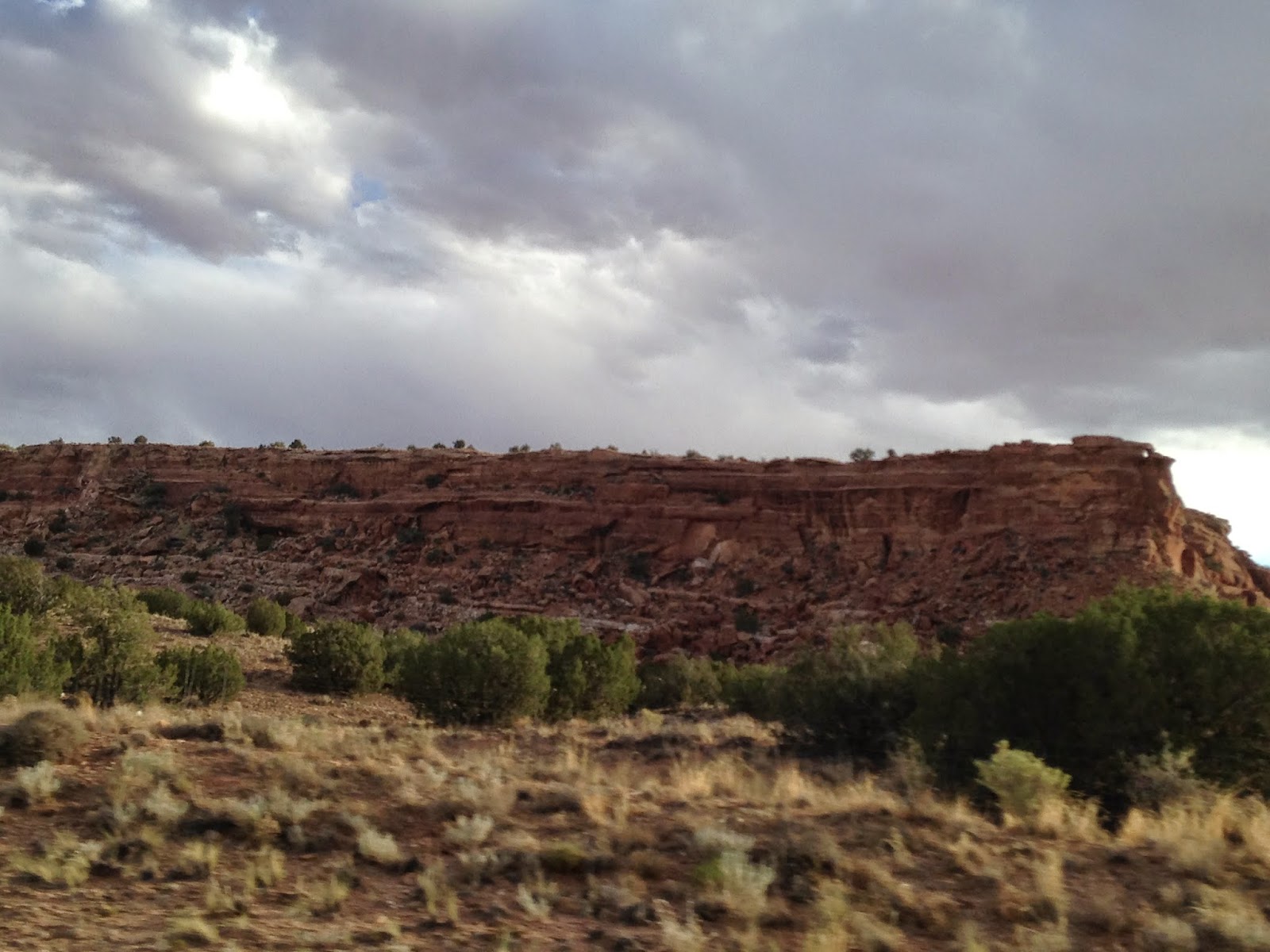
When we were moving for our allotted 20 miles (one time it ended up being about 45 miles!)...I still enjoyed taking pictures of the beauty of New Mexico.
The billboard below was just plain torture for us....on our sputtering journey to Texas....we quite possibly were parked beside it on one of our pit stops!!
I am not sure if you have ever noticed the signs that say Purple Heart Trail on them before as you travel, but it kept my mind off of our motorcycle troubles. I did find info on the trails on The Military Order of the Purple Heart website.
| The purpose of the Purple Heart Trail is to create a symbolic and honorary system of roads, highways, bridges, and other monuments that give tribute to the men and women who have been awarded the Purple Heart medal. | ||||
| The Purple Heart Trail accomplishes this honorary goal by creating a visual reminder to those who use the road system that others have paid a high price for their freedom to travel and live in a free society. Signs placed at various locations annotate those roads and highways where legislation has been passed to designate parts of the national road system as The Purple Heart Trail. The actual format and design of the signs varies from state to state. There are currently designated sections in 45 states as well as Guam. |
We finally made it to the end of New Mexico and that meant we were getting closer to Amarillo!!
It became a game of sorts....we would pass semi-trucks and vehicles while the bike was running and cooperating....only to have it shut down and then we would pull over, and they would pass by us. I gained a new appreciation for the vehicles that did get over in the far lane as they passed, instead of those who came very close to us at a high rate of speed. And these semi-truck drivers that haul three other trucks behind them....impressive to me. I would never be able to do that!
Hallelujah and Praise the Lord!!! Only about 55 more miles to go!! As soon as we got into Texas, a couple of highway workers pulled over to help us. We thanked them and explained the situation. They wished us luck in getting to Amarillo. Also, the only person who stopped while we were in New Mexico was a guy from Oklahoma. Our best option was to just keep moving along as we were, in hopes of getting to the Harley Shop, or else have them come and pick us up and pay for the tow. As long as it kept running when we would unplug and replug, we kept going!
Wind turbines near the Texas-New Mexico border.
You can't even imagine how tired I was of running over these things every 20 miles or so.....rumble strips on the right side of the road to let you know when you are over too far. It was really getting old by the time we limped into this place....
Finally!!! The mechanic here at Tripp's Harley Davidson in Amarillo was extremely helpful and friendly. Unfortunately, we had to sit for about two hours or so while they ran diagnostics and figured out the problem. The culprit? A broken wire that runs to the fuel injection module...there was no way that we would ever have been able to fix it on the road. As soon as it was fixed the mechanic sent us on our way without making us fill out the paperwork (still under warranty) because he knew we were heading to Oklahoma and there were storms headed that way. Of course!
This was a sign along the highway that showed me that we were being guarded and watched (we had many family members and friends praying for our travels). Right after we got on the road again from the Harley shop a song came on that said it all Everything is Beautiful by Engelbert Humperdink. Yes, everything is beautiful, and although obstacles are put in our way in life, we can always choose to believe that things will work out for our good.
The final state of our 10 state trip!! It became a race with the storm clouds, plus it was apparent that due to our Harley issue we would not get home before the sun set. Flashes of lightning and booming thunder surrounded us and seemed to be chasing after us once we hit Oklahoma City and headed north.
The skyline before the sun went down was actually very pretty. Once it got dark it became somewhat scary.....windy at times and then very calm. Just north of Oklahoma City we pulled off and parked beside a fire department building to see where the storm was heading. Checking the weather apps on our phones, we had to make a decision about whether to take the chance and continuing on or finding a safe place to spend the night. Knowing we weren't very far from home, we just kept moving north---hoping for the best. Although it wasn't actually raining, we still got wet from the vehicles passing us and spraying us with the water from the road. At long last we reached Highway 51 to head east towards Stillwater....20 miles or so left!! Lightning and thunder still abounded, and we were wet and now getting chilled.....even though it was June. It wasn't 10 minutes after we pulled into our garage (approximately 10:45 p.m.---over five hours past our original estimated arrival) that the rains came in earnest! God had smiled on us and got us home safe and sound.
Many prayers from many people had carried us across 10 states, over almost 4,000 miles, through numerous national parks, through heat and wind and rain and sunshine, visiting amazing friends, seeing spectacular sights, and many other adventures. A HUGE thank you to Jan and Randy Beckman for sparking the whole idea in the first place!! Unforgettable trip for sure! Also a big thanks to my Mom for watching our dog, Monroe, while we were gone. To the Creech family in Fort Collins as well...great hospitality and fun!! And to all of you who have read this travel blog this past year....thank you so much!!! I appreciate that you take the time to read and check out the pictures!! I wonder where the next trip will be??? Until then...happy trails......
Sunday, February 15, 2015
Crazy Travels on 2 Wheels: The Grand Canyon is more than GRAND!!
Crazy Travels on 2 Wheels: The Grand Canyon is more than GRAND!!: For years and years I have been dreaming about seeing The Grand Canyon....and on this trip it finally came true!! Although it wasn'...
The Grand Canyon is more than GRAND!!
For years and years I have been dreaming about seeing The Grand Canyon....and on this trip it finally came true!! Although it wasn't exactly on our way home, we made the decision to swing by the South Rim. In case you can't tell....I was MORE than excited!!!
We took off from Williams, AZ after a great breakfast at the hotel we stayed at. A couple from New Zealand were staying in the room next us and had been in the United States for a month driving across America on Route 66. They added that it was frustrating at times as they would be driving along and it would just end, making them turn around and backtrack for up to an hour at times. Route 66 goes right through the center of Williams. We wished them well and headed out for the Grand Canyon.
After a 60 mile ride, we had to wait in line to get through the entrance gates...I was so excited that I couldn't even stand it!! Over five million people visit the canyon each year. It was a gorgeous day in June when we visited.
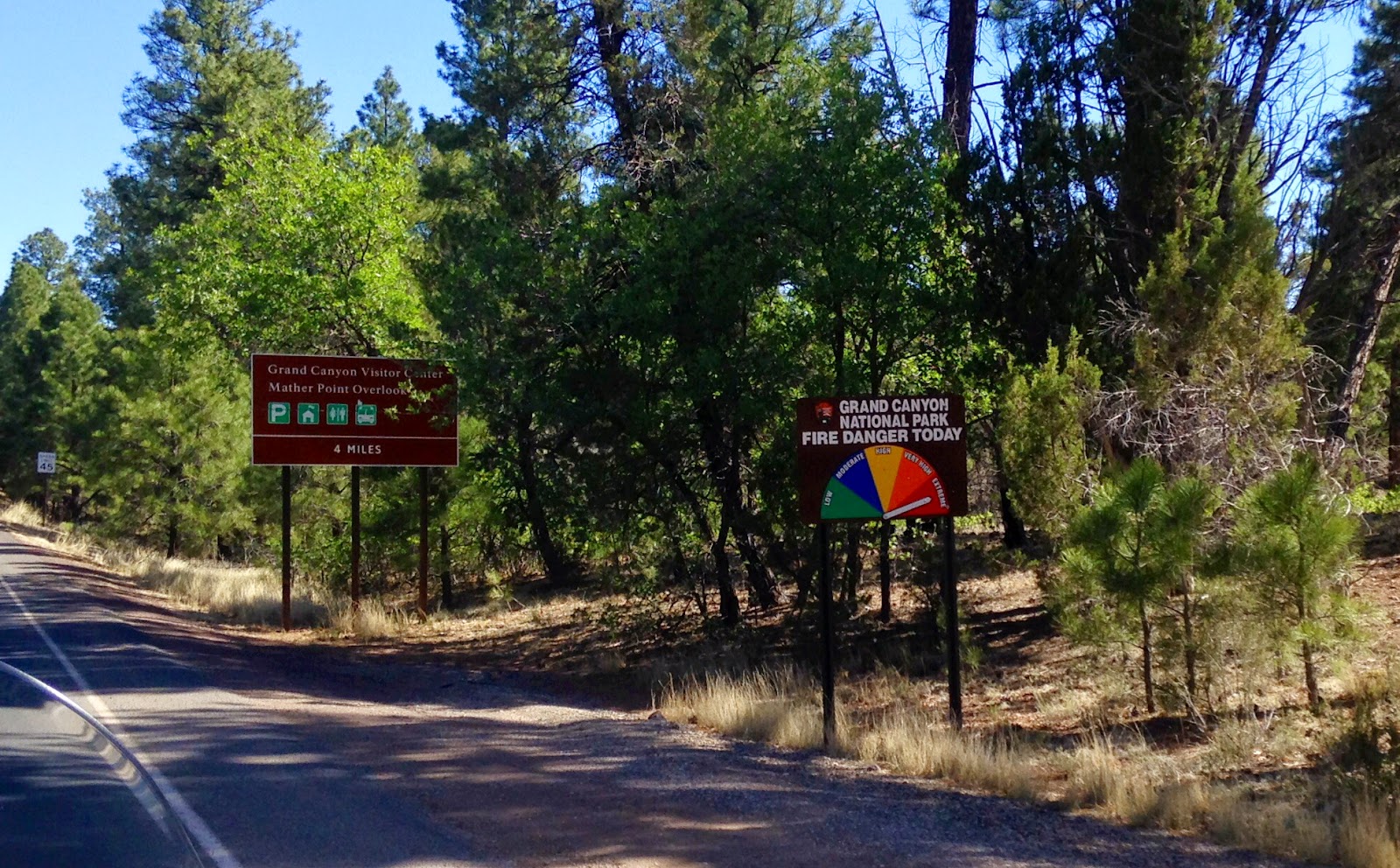
Once you get into the park area it is still several miles before you actually come to a lookout area. As you can see from this sign, the fire danger back in June 2014 was high! We stopped at a visitors area where we went to Mather Point....
Not too close to the edge....yet....
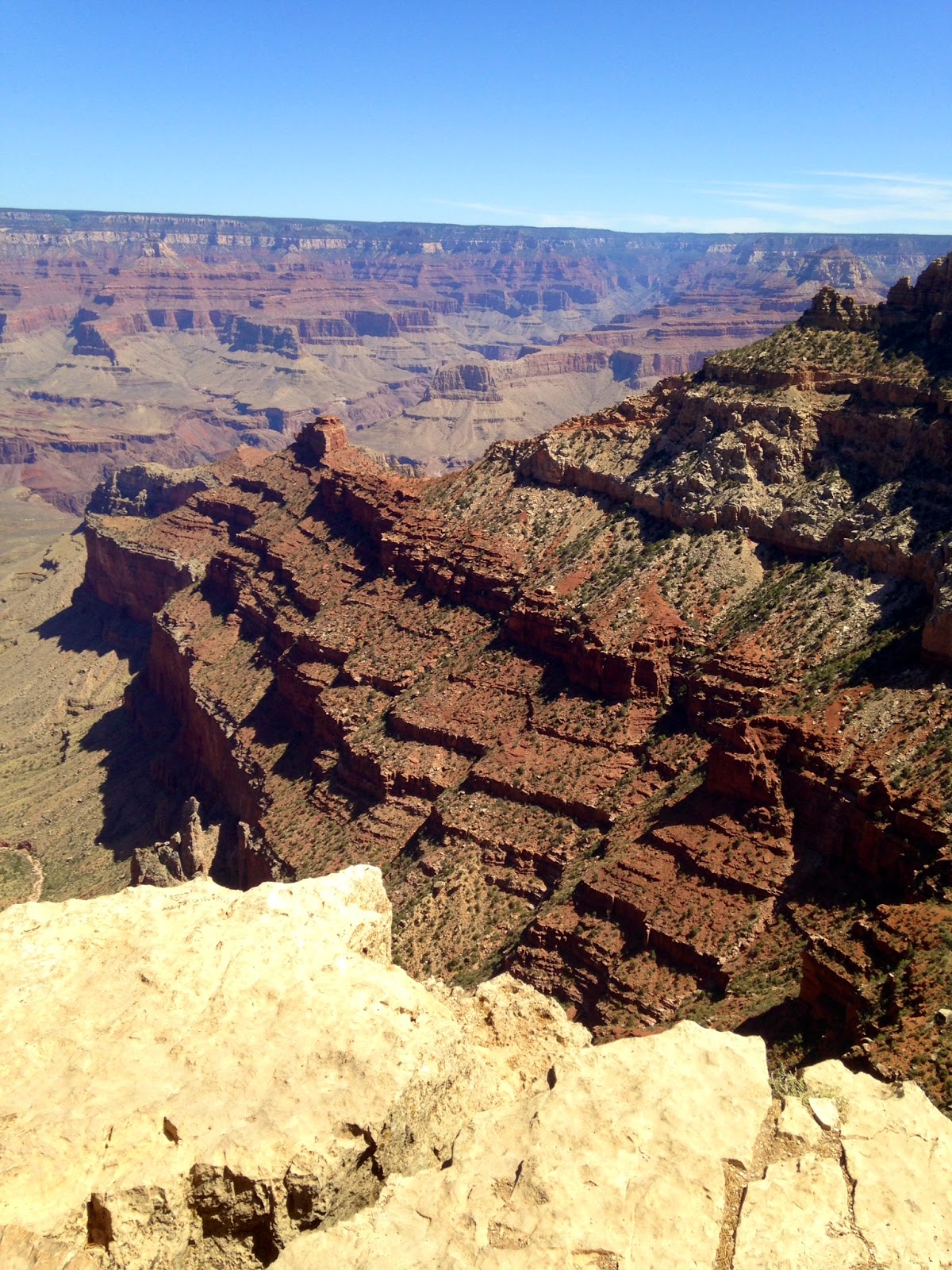
The South Rim is the most frequently visited side, as it is easily accessible. The train also runs from the South Rim. The North Rim is only about 10 miles away as the crow flies, but would take 212 miles of driving to reach. It is almost a mile deep at Mather Point when you peer over the edge.
This overlook point is the most visited each year with more than 5 million visitors. Mather Point is the most congested spot due to all of the amenities offered there.
Words absolutely cannot contain the beauty and splendor of this amazing natural wonder....
It was interesting how there were so many trees that appeared to be growing out of the rocks! Amazing....
There are colors here that you won't find in a box of 64 Crayola Crayons....completely indescribable.
After leaving Mather Point, we drove toward Desert Point. Here we found the Desert View Watchtower.
This was the vision of Mary Coulter, who designed the tower to resemble the tower of the ancient Anasazi tribe that lived there. It was designed and constructed in 1932 to resemble drawings found at the Four Corners Region.
Some of the artwork on the inside of the tower. There were three levels to the tower. The first level was a gift shop with souvenirs, and then a narrow rock staircase winding around the side of the tower led to the second and third levels.
Terry at the top of the stairs! It was a workout to get to all levels, but the view from the top was unbelievable!
My view from the top level looking down....it was an interesting place to stop and explore.
A view from the top level...as you could step outside to see an awesome view from 77 feet up!
The L-shaped window from the third level must have been built in honor of my name...right?? Pretty cool view looking out.
Looking closely you can see the Colorado River snaking through the canyon.
The Grand Canyon was carved by the flowing of the Colorado River over six million years. It continues flowing 500 miles to the Sea of Cortez at the Pacific Ocean.
As you can imagine......I probably took a bazillion pictures!! The majestic glory of this fascinating natural wonder cannot be appropriately captured by cameras. I could add 50 more pictures here, but my suggestion to everyone who has not made the trek to the Grand Canyon.....GO!!!!
This is a video as we were driving out of the Grand Canyon....lots of trees and then an open are where you could still see the canyon! Beautiful doesn't even come close for a description.
Our goal after the Grand Canyon was to make it to Albuquerque by the end of our day, which meant we left the Kaibab National Forest (which is part of the Grand Canyon), and part of the Painted Desert as well on our way to Interstate 40.
So many interesting things that caught my eye as I rode on the back....
Yes....that is a dinosaur up there....YIKES!!
This is Fort Defiance, which was on Route 66. Although we did not have to time to stop and go through it, it is located in Navajo Territory on the eastern edge of Arizona. We kept waiting for the switch to mountain standard time, until we realized that most of Arizona does not follow Daylight Savings Time. Next, we stopped in Winslow, Arizona for fuel and some water....then I had to Google the lyrics from the Eagles song..."well, I'm standing on a corner in Winslow, Arizona...such a fine sight to see..." from their song Take It Easy. Terry and I couldn't remember what song it was from! I guess I should have had him take a picture of me standing on the corner of the quick shop we stopped at!!
Arizona has so much beauty to enjoy....it is so peaceful to sit back and watch landforms and other scenery in America zip by us. I enjoy taking pictures of the amazing sights....
I wish we would have had time to stop at this landmark as well....it is a meteor created crater that is outside of Winslow. We just didn't have time...maybe next time!
As you can see, it was a gorgeous June day...perfect for traveling on two wheels. It wasn't long before we hit the border and headed on into New Mexico....definitely The Land of Enchantment.
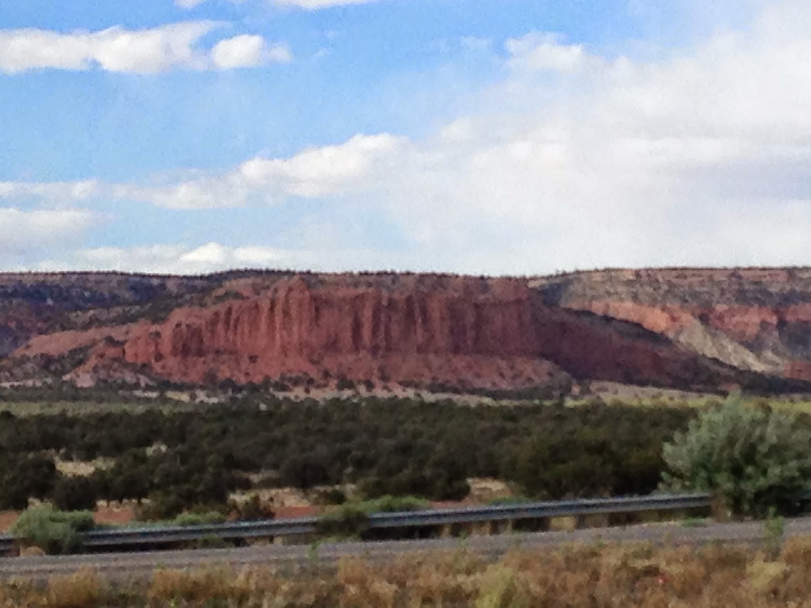
New Mexico is a state that I would love to go back to when we have more time to explore. Such majestic beauty as we continued on Interstate 40. Shortly after Gallup we crossed The Continental Divide. This line extends from the Bering Strait to the Strait of Magellan and separates the watersheds that drain into the Pacific Ocean from the river systems that drain into the Atlantic Ocean, and those that drain into the Arctic Ocean in the northernmost areas of the Divide.
I believe that some of these pictures show some of the Sacred Mountain area in New Mexico. It is Navajo land that encompasses areas in Colorado, Arizona and New Mexico, with many amazing peaks and mountain ranges.
We continued to get closer to Albuquerque....
We rolled into Albuquerque at about dinner time...thanks to the time change to Mountain Standard Time at the border. We found a motel for the night...and then proceeded to find something tasty to eat. As I recall...it involved Mexican food and a margarita! It was about ten hours on the bike that day, perfect weather for traveling. One more day of our adventure awaited us in the morning.....the final day when we would roll into Oklahoma before dark (if all went as we had planned!).
Join me for the final installment next time as we venture from Albuquerque to Oklahoma. What could possibly go wrong after more than ten days on the road???
Subscribe to:
Comments (Atom)


.jpg)


.jpg)
.jpg)

.jpg)
.jpg)

.jpg)


.jpg)


